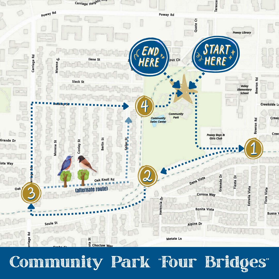
Poway is known for its trails, but not all adventures take you up a mountain! This is the perfect time of year to explore nature around the Poway Creek with an easy “Four Bridges Walk” from Poway Community Park.
- Start at Community Park and head southeast past the ballfield to the Bowron Road bridge.
- Double back over the bridge to continue west on the Poway Creek Trail (north side of the creek). Cross the creek on the Poway Creek Trail Bridge and walk west along the trail as it parallels Soule Street.
- Cross the Carriage Road Bridge and either walk north on Carriage to Buckley Street, or turn right on Oak Knoll Road and you might catch a symphony of birds singing in the trees that line the median.
- Head north on any of the residential streets until you reach Buckley Street - then turn right and you will cross the last bridge as you enter the park. It's about a 45-minute walk (depending on your pace and stops along the way).
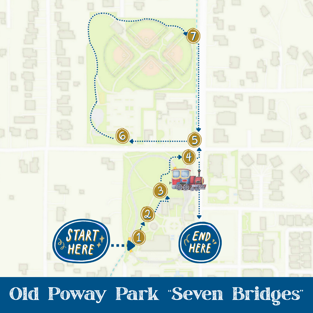
Keeping with the theme, head on over to Old Poway Park for a short “Seven Bridges Walk.”
- Start at the back of the Hamburger Factory (near the restrooms) and cross the Old Poway Park South Bridge toward the train track.
- Follow the path north and cross back over Rattlesnake creek at the “Middle Bridge,” and then head north to cross back west again at the “North Bridge.”
- Follow the path north and cross the creek once again on the Train Barn Bridge to Midland Road.
- Cross Aubrey Street at Midland and then cross the Midland Road South Bridge heading west and across the parking lot to the Aubrey Park.
- Just inside the park, take the pathway on the south side of the parking lot to cross the Aubrey Park Bridge and then follow the pathway around the park until you reach the pathway that crosses the Midland Road North Bridge.
- Follow Midland Road back to the park.
Poway's GIS map includes a "Bridge" layer. To find it, click on the "Map Layers" icon, expand the "Street and Traffic" section, then select "Bridges" to view all of Poway's bridges.